Costa dei trabocchi
Cycling through breathtaking scenery in an enchanted and timeless landscape
The Costa dei Trabocchi is a stretch of coastline spanning approximately 40 km, from Scoglio di Trave in the territory of Vasto to Ripari Bardella beach, located between San Vito Chietino and Ortona. It is famous for the presence of “trabocchi,” wooden fishing platforms erected on the rocks and equipped with simple fishing gear. These structures have been used by local families for hundreds of years and are often transformed into picturesque restaurants today.
The uniqueness of this coastal stretch lies primarily in its natural beauty. The hills that plunge into the sea among the cliffs create a one-of-a-kind scenery in the central Adriatic region, between Conero and Gargano. One can enjoy breathtaking views from Punta Aderci, the highest cliff towering at 36 meters.
The other distinctive feature is its human presence. Lacking natural harbors and large sandy beaches, this area has never seen the development of coastal towns. It remains largely wild and uninhabited to this day, despite the presence of ancient urban centers behind it (such as the cities of Vasto, Lanciano, and Ortona, which have been significant since Roman times). The proliferation of trabocchi along the coast is likely attributed to the practice of building wooden piers for docking ships already in medieval times.
The area where trabocchi can be observed is essentially divided into two parts, north and south of the mouth of the Sangro River. The first zone includes the municipalities of San Vito Chietino, Rocca San Giovanni, and Fossacesia. The second zone is part of the large territory of Vasto. In between, the coastlines of Torino di Sangro and Casalbordino, located upstream from the river’s mouth, have long pebble beaches and do not feature any trabocco, except for the one at Punta Le Morge.
Until the 1990s, a railway ran along this stretch of the coast, built in the 19th century practically on the cliffs. With the realignment of the railway track in most parts, the beautiful cycle path of the Costa dei Trabocchi, also known as the “Via Verde,” was created, making it easier to reach and explore previously hard-to-reach and inaccessible places.
In Vasto, you can ride the southernmost section of the Via Verde and get up close to several trabocchi. You can also visit the two natural reserves of Marina di Vasto—the stunning, expansive sandy beach that is the main tourist attraction of the city—and Punta Aderci. All of this can be done with the opportunity for frequent stops and detours to visit romantic seaside chapels, Italy’s second tallest lighthouse, Spanish watchtowers, or archaeological sites that attest to human presence in these areas since the Neolithic period!
What are you waiting for? Hop on your bike and join us on the four itineraries we have prepared just for you!
The Golden Gulf from Vasto to San Salvo
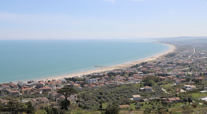
Marina di Vasto is now a renowned seaside resort, but it used to be a small hamlet where the train and a few fishing boats would arrive, and there were some small industrial activities such as a brick kiln that used the local clay for brick production. With the relocation of the Adriatic road from the city center to the new route along the sea, development began, merging the hamlet with Marina di San Salvo into a single urban fabric along the state highway. However, a visit to Marina di Vasto offers much more than just a stroll along any waterfront, thanks to its historical landmarks and the preserved natural beauty.
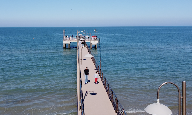
In this itinerary, you can see the medieval-style villa of Alfonso Marchesani, which was later used as an internment camp during the fascist regime. Adjacent to it is the church donated by the same magnate to the Capuchin friars, who are still strongly present in the area. You can also admire the modern pier, reminiscent of the wooden freight dock that was present on the beach for many years.
From the waterfront of Vasto, you can take the cycle path that connects it to San Salvo and discover the fantastic dune environments where birds such as the Kentish plover still nest. At the mouth of the Buonanotte stream, in the territory of San Salvo, you will find yourself in a small marshy area protected within the Mediterranean Botanical Garden. There, you can observe how most of the lower Abruzzo coast appeared before the land reclamation carried out in the last century.
The Green Path and its beaches
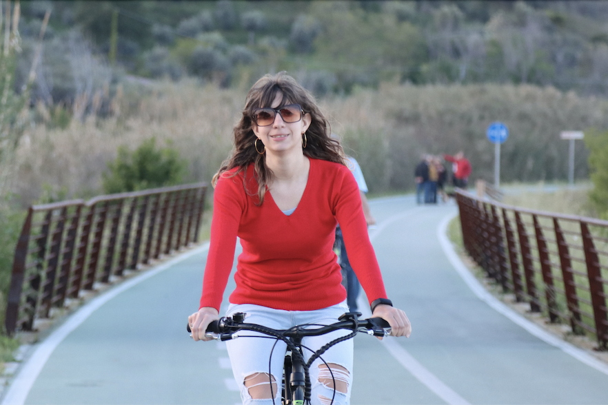
The Green Path, or Cycle Path of the Costa dei Trabocchi, starts from the old train station of Vasto Marina, a late 19th-century building, and winds its way north along the cliff between the Gulf of Vasto and the hamlet of Vignola, following the route of the railway built in 1862 to connect the regions of the lower Adriatic to the new Kingdom of Italy. Along this approximately 6-kilometer stretch, there are numerous spots to stop and descend to the sea to admire the coves and trabocchi that dot every cliff protruding into the sea.
After a short initial stretch still within the village of Vasto Marina, you reach the Scaramuzza rock. Here, it is obligatory to stop and admire the Monument to the Bather, a large bronze sculpture by the artist Aldo d’Adamo, which has been the symbol of the city of Vasto since 1979. In the same area, on the shallow seabed, you can observe the remains of Roman walls, likely the foundations of ancient port structures, within the submerged Archaeological Park of Vasto.
Continuing north, a few hundred meters away, the first access to the sea leads to Trave Beach and the large trabocco of the same name. It is the first (or last, depending on the starting point) trabocco along the coast, but it is also the oldest landing site on the Vasto coast, according to legend, the place where the Homeric hero Diomedes arrived while fleeing from Troy to found the ancient pre-Roman Histon.
From Trave Beach onwards, you will encounter countless enchanting beaches accessible on foot via short paths, each more beautiful than the last: Cungarelle, Casarza, Torricella, San Nicola, La Canale. The endpoint of the itinerary is Vignola, a charming suburb of Vasto characterized by a few villas with direct access to a large pebble beach. Once a malaria-prone area in the distant past, today it is a pleasant and highly sought-after destination in the entire region.
San Nicola and Punta Penna
If you want to combine natural beauty and landscapes with history and architecture, this is the itinerary for you. Starting from the city center, through a short scenic route, you will reach the Church of San Nicola della Meta, a rustic 17th-century building that stands out against the blue sky and sea on a panoramic viewpoint from where you can observe the trabocchi. From there, descending onto the Adriatic State Road, which peacefully runs amidst greenery in this stretch, you can reach Punta Penna in just a few kilometers.
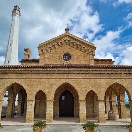
Here, as you ascend the promontory, you will be welcomed by the romantic church of Madonna della Penna, a 19th-century reconstruction of the ancient church of Sant’Elena. You are at the site of the medieval village of Pennaluce, revived during the Frederickian era and incorporated into Vasto in 1416 after being destroyed by the Venetians. You are also on the ruins of the Roman city of Aspra or perhaps the mythical city of Buca, and certainly on a site inhabited for 3,000 years, as evidenced by the excavations carried out beneath the apse of the church. Behind the temple, you will find the gigantic lighthouse built in 1912, the second largest in Italy.
Moving to the other side of the promontory, next to the 16th-century Spanish watchtower, you’ll enjoy a marvelous view of Punta Penna Beach, one of the most beautiful in Italy, and the promontory of Punta Aderci. Below you lies the port, built in the 1950s and now an important commercial terminal for the lower Abruzzo region.
On your way back to Vasto, you’ll have the opportunity to pass through the hamlet of Incoronata, an important suburb that grew in an agricultural area around the sanctuary built in 1738. The sanctuary was reconstructed in the mid-19th century and completed in 1938.
Trekking in Punta Aderci Park
To see the most beautiful beaches and panoramas of Vasto, you need to leave the Cycle Path of the Costa dei Trabocchi (Green Path) and venture from the Adriatic State Road into the industrial area north of Punta Penna. Just a few hundred meters from the main road, the road ends with a steep slope that descends towards the beach. At your feet lies the marvelous cove of Punta Penna, a corner of paradise that has been spared from mass tourism thanks to the construction of the industrial zone and the nearby port.
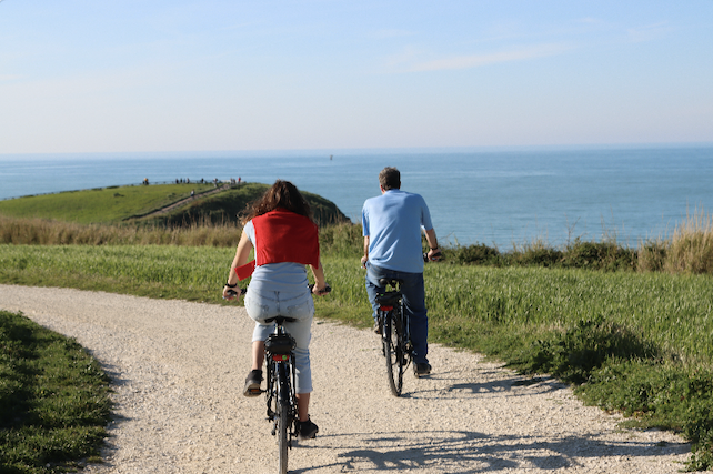
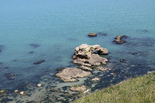
At the end of the small industrial zone, a dirt road starts leading to the promontory of Aderci. Once you reach the cliff, you can admire a breathtaking panorama from the site that was once dedicated to the god Hercules. Below the promontory, you’ll find a characteristic trabocco (a traditional fishing machine on stilts) and small sea-carved caves in the rock. Continuing along the trail, you’ll pass through a tiny agricultural village and reach the Mottagrossa grove, an almost impenetrable place that harbors a wide variety of animals, including wolves and wild boars, right by the seaside.
You can descend to the sea to overlook the large pebble beach, probably the wildest in Abruzzo, or safely follow the dirt track that traverses it until you reach the old railway bridge over the Sinello River. There, on the outskirts of Vasto, you can climb the hill and enjoy a fantastic panorama of the river valley near the ruins of what was once Castel Sinello, a medieval castle built on a site dating back to the Neolithic period.

